different modules
powerful field software
For Android OS
On this page:
![]()
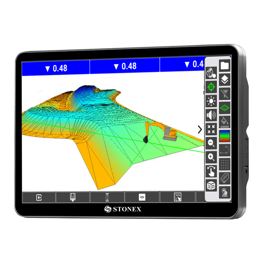
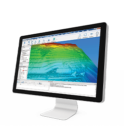
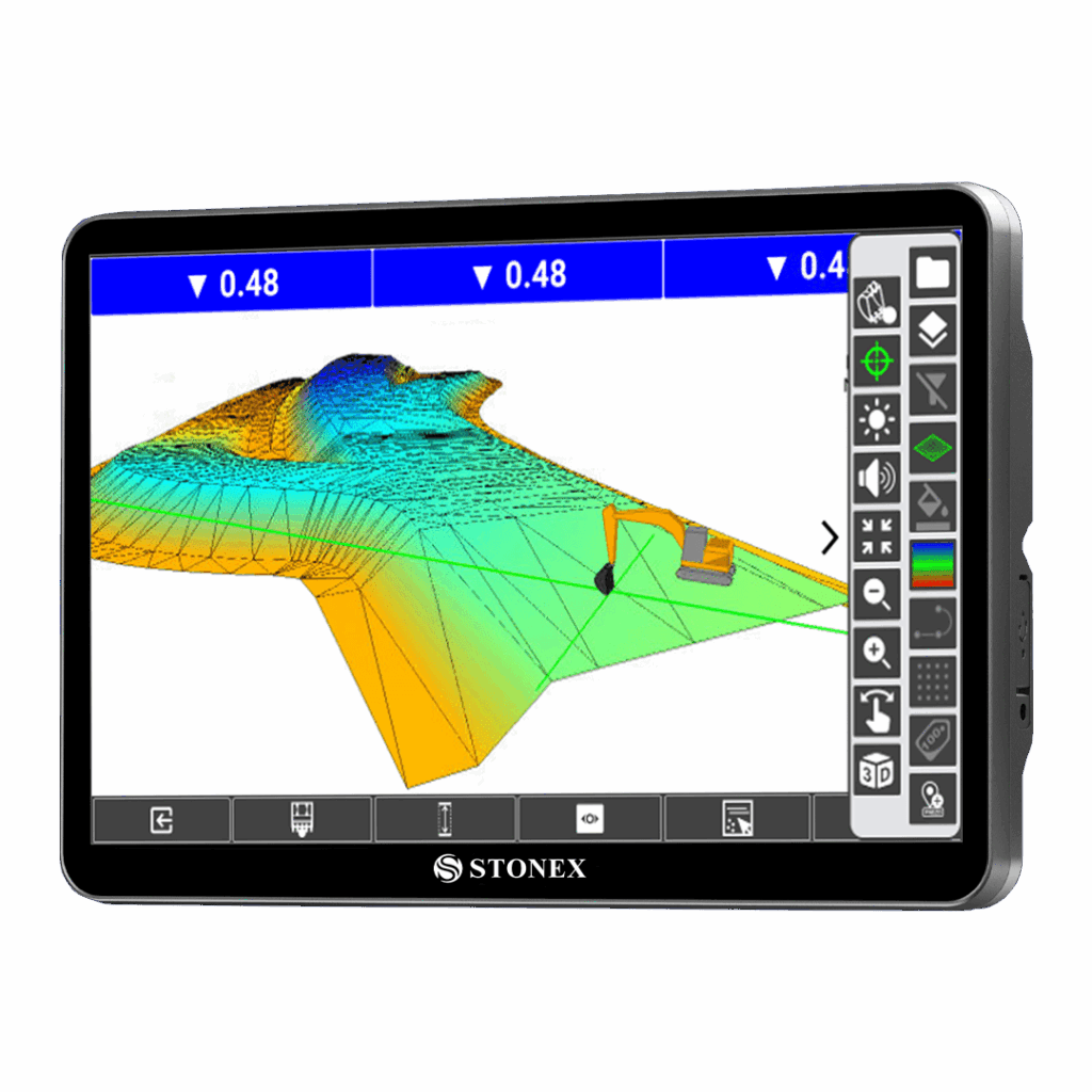
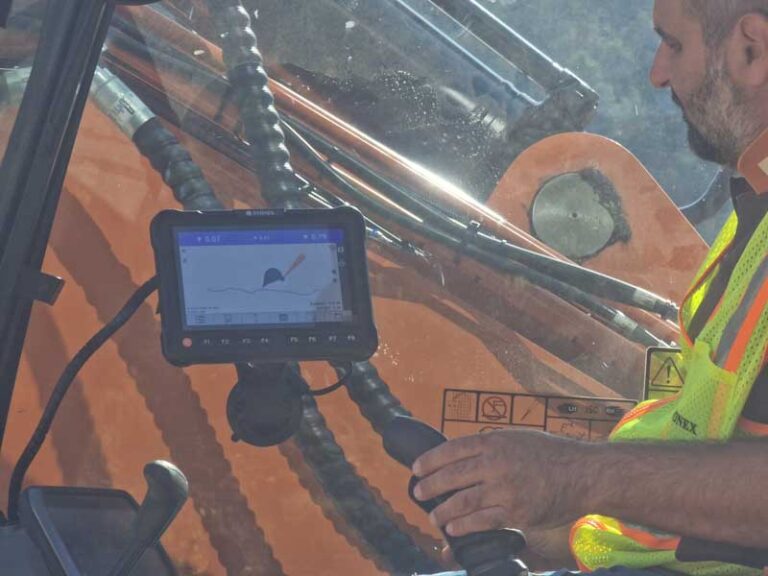
STX-MC software is fully developed and supported by our experienced Stonex development team in Milan, Italy. The software represents the heart of all our machie control systems and it’s created with a strong focus on the real needs of machine control users: simplicity, reliability, and flexibility.
We use one software for all types of machines and applications. You simply activate the functions you need by choosing the right license level: 1D, 2D, 3D
Key Features:
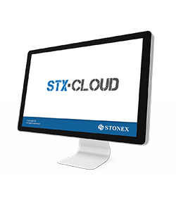
STX-MC software works seamlessly with the STX-Cloud platform, remote access for quick support and real-time project updates.
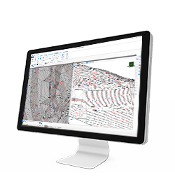
STX-MC can also share files with Cube-a software.

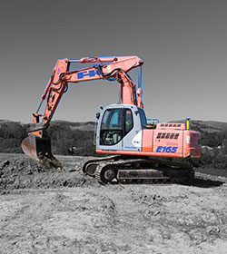
A module for managing all excavator-digging tasks. Complete management of the boom and the bucket.
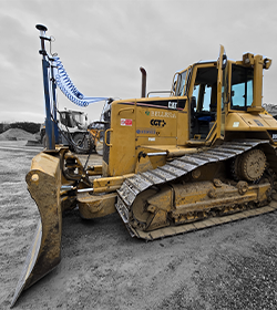
A module for grading operations with dozers. Complete management of earthmoving tasks and blade control.

A module for earthmoving operations with wheel loaders. Complete management of loading and material handling.

A module for grading operations with motor graders. Complete management of blade positioning, leveling, and surface finishing.
Simple and fast interface, easy to manage during all excavation and leveling operations. Designed for those who work on board the machine and need intuitive software.
SWING BOOM
TILT ROTATOR
TILT BUCKET
MAP COLOR
POINT LOG
CLOUD COMMUNICATION
• Job management
• Survey Point Library
• System settings (units, precision, parameters, etc.)
• Import/export ASCII and DXF
• Import/export ESRI shapefiles (with attributes)
• Export Google Earth KML/Send to Google Earth
• Import Raster Image
• Share files by cloud services, e-mail, Bluetooth, Wi-Fi
• Customizable ref. systems also by remote RTCM messages
• Features codes (multiple feature tables)
• Fast Coding Panel
• Define GIS features
• Define GIS attributes
• All brand bluetooth disto support
• Support for Stonex receivers
• Generic NMEA (support for third party receivers) – Rover only
• Receiver status (quality, position, sky view, satellites list, base info)
• Full support for features like E-Bubble, Tilt, Atlas, SureFix
• Network connections management
• Support of RTCM 2.x, RTCM 3.x, CMR, CMR+
• Automatic GNSS model & features detection
• Automatic antenna offset management
• Bluetooth and Wi-Fi GNSS connection
• TS Bluetooth
• TS Long Range Bluetooth
• Search and prism tracking (Robotic only)
• Compensator interface
• Station on point
• Free station / Least squares resection
• TS orientation st.dev. and check orientation
• Topographic basic calculation
• Rotate to GPS position3
• Rotate to given point
• Export TS raw data
• Export mixed GPS+TS raw data
• Grid Scan
The solution STX-DIG (2D module) determine the direction/heading using two passive antennas set on the cabin roof. The passive antennas are connected with a dual Antenna GNSS Receiver integrated into the Android Tablet. The tablet provide just the heading when it is used in 2D and stand-alone way (without the use of any correction). Without any correction (Ntrip or Base) the GPS sensors will be use only like a compass heading. In this way it is possible to know the Excavator Rotation with a precision of 0.2°
In 1D or 2D module, when the excavator is moved, the operator use the laser receiver installed on the stick to the laser reference plan when he moves the excavator.
The 2D ½ module use the NTRIP signal to get elevation through the GPS antenna. In this way the operator does not need any Laser Receiver on Excavator Stick and Laser Level.
The main characteristics of the angle sensor are speed, reliability and reduce dimension:
The sensor can be fit on the machine using a weld Bracket Place (included in the solution)
Yes, it is.
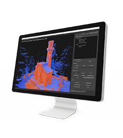
In March 2022 Stonex had the opportunity to carry out a series of surveys inside and outside the “Torretta Viscontea” located in the Monza Park.
* Mandatory field
Stay up to date with the latest news, products, promotions
and events from Stonex.