STX-DIG | EXCAVATORS
STX-DIG system can be quickly and easily installed on almost any excavator — from compact mini models to large machines used in mining operations.
Thanks to a streamlined hardware and software design, you can be up and running in no time. The system is powered by STX-MC software, fully developed and supported at our European headquarters in Milan, Italy. Every component is designed for fast installation, quick calibration, and immediate productivity.
Key Features
- Universal Compatibility
Works with a wide range of excavator brands, models, and sizes — seamless integration guaranteed.
- Scalable System Architecture
Easily upgrade from 1D to 2D or 3D Pro. Just add components based on the level of precision and functionality you need — no full or partial system replacement required.
- Quick Installation & Deployment
Engineered for fast setup and minimal machine downtime — your team can be operational in hours, not days.
- Intuitive, Operator-Friendly Software
STX-MC provides a clean, user-centric interface for efficient machine and excavation control, even for first-time users.
- Reliable Support, When You Need It
Get fast, professional support directly from our EU team, to keep your projects moving and avoid costly downtime.
Whether you’re managing trenching, grading, or complex earthworks, STX-MC gives you full control of every phase of your excavation process. The system grows with your needs — start with a 1D configuration, and upgrade to 2D or 3D Pro at any time, without replacing existing components.
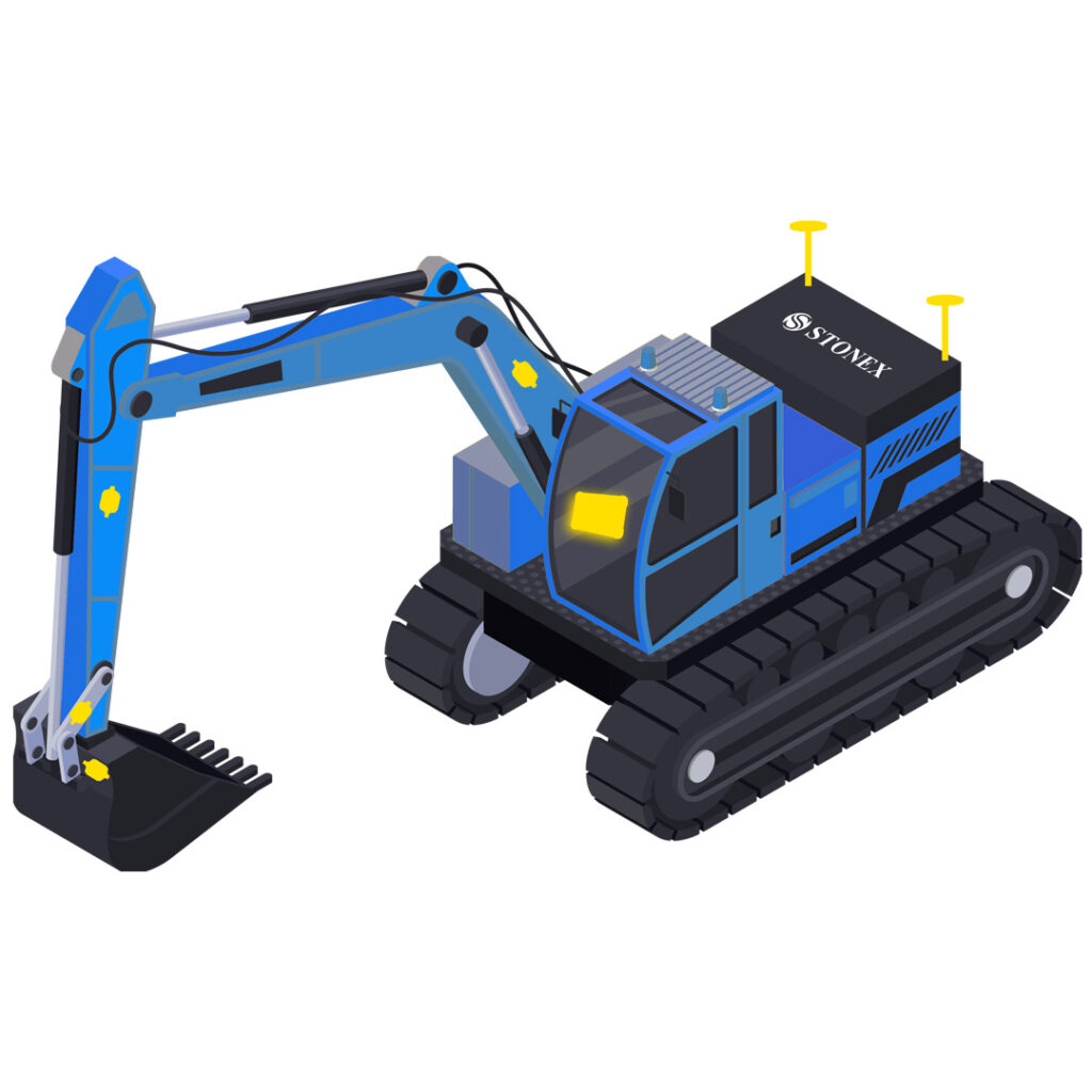
Compatible with all machines
Qualified Technicians for installation and training
Simplified work for everyone involved in earthmoving operations
Return on investment through increased efficiency
CONFIGURATIONS
- 1D
- 2D
- 3D
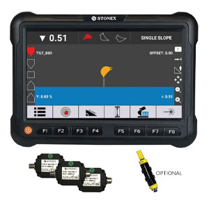
STX-DIG 1D is the entry-level solution in the Stonex Machine Control lineup — perfect for those looking to bring precision and efficiency into excavation without a large upfront investment.
This system uses sensors installed on key points of the machine (single or dual boom, stick, bucket, and frame) to control the bucket’s position in one dimension (side profile view). It enables accurate work on one-dimension slopes and surface, increasing productivity while reducing guesswork.
Need to reposition your machine?
No problem — the system allows reallocation using either a reference point (to retain height values) or an optional laser sensor.
Affordable Entry Point
The easiest and most cost-effective way to get started with high-precision excavation using Stonex technology.
Scalable for the Future
Thanks to the modular STX-MC platform, your 1D system can be seamlessly upgraded to 2D or 3D Pro by simply adding components — such as additional sensors, GNSS receivers, antennas, and cables.
Main components
Sensors (frame, one or dual boom, stick, bucket), Apollo tablet, cables.
Optional components
Laser sensor, Tilt sensor, Dual Boom sensor
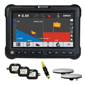
STX-DIG 2D is the next step in the STX-DIG product family — combining all the components and benefits of the 1D system, with enhanced capabilities for even more demanding excavation tasks.
Thanks to two SA45 GNSS antennas connected directly to the tablet, the system can automatically detect the boom heading and bucket orientation. This enables full control in two dimensions — including flat surface work, two slopes, and boom rotation around its pivot point.
If your excavator has a tilt bucket, you’re in luck: simply add an optional tilt sensor and gain real-time tilt control with maximum accuracy.
Need to reposition the machine?
No problem — the system supports quick reallocation using either a reference point (to preserve height data) or an optional laser sensor.
STX-DIG 2D is the ideal solution when your project goes beyond what 1D can offer, but full 3D GNSS guidance isn’t an option — such as under roofs, indoors, or in GNSS-blocked environments.
Scalable for the Future
The upgrade from STX-DIG 1D to 2D is both cost-effective and value-rich, giving you powerful capabilities with minimal additional investment. Need more features & capabilities? Thanks to the modular STX-MC platform, your STX-DIG 2D system is fully upgradeable to 3D Pro. Just add GNSS receivers, cables, and supporting components — no need to replace your system.
Main components
Sensors (frame, one or dual boom, stick, bucket), Apollo tablet, GNSS antennas, Cables.
Optional components
Laser sensor, Tilt sensor, Dual Boom sensor
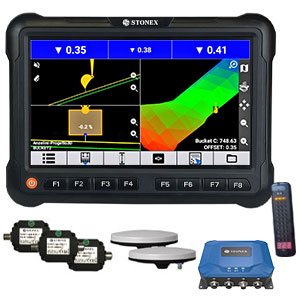
STX-DIG 3D Pro is the top-tier solution in the STX-DIG family — a high-performance machine control system designed to unlock the full potential of your excavator. Built for professionals, it delivers maximum productivity, time savings, and cost-efficiency on every job site.
Equipped with the SMC-TWO GNSS receiver, STX-DIG 3D Pro allows you to work with high precision anywhere on the site. The receiver supports both mobile (NTRIP) and UHF radio corrections, ensuring maximum accuracy even when mobile signal is unavailable.
Working with a project file?
Simply upload your design in .DXF or .XML format — and dig with confidence, knowing you’re exactly where you need to be.
Doing a simple job?
No problem. With the intuitive STX-MC software, you can easily create local projects on the go: flat surface, surface from A>>B, Flat area, Trench Drainage, Terrain model
Project Sharing
Managing a large fleet or the excavator is too far away to visit personally? Use STX-Cloud to share and sync projects across all tablets office remotely — in real time.
Remote Support When You Need It
If something goes wrong, service team can connect to your system online for fast troubleshooting — no on-site visit required.
Tilt & Tilt-Rotator Integration
Have a tilt bucket? Just add a tilt sensor and gain full control.
Using a tilt-rotator with ECU? Connect it via CAN bus and take full control of bucket’s movements with precision.
Already using STX-DIG 1D or 2D? Easy Upgrade!
Upgrading to 3D Pro is easy and cost-effective. Add the required components, and instantly unlock powerful new capabilities — no full system replacement needed.
Main components
Sensors (frame, one or dual boom, stick, bucket), Apollo tablet, GNSS antennas, SMC-TWO GNSS receiver, Cables.
Optional components
Laser sensor, Tilt sensor, Tilt-Rotator Sensor with ECU (factory-equipped machines only), Dual Boom sensor
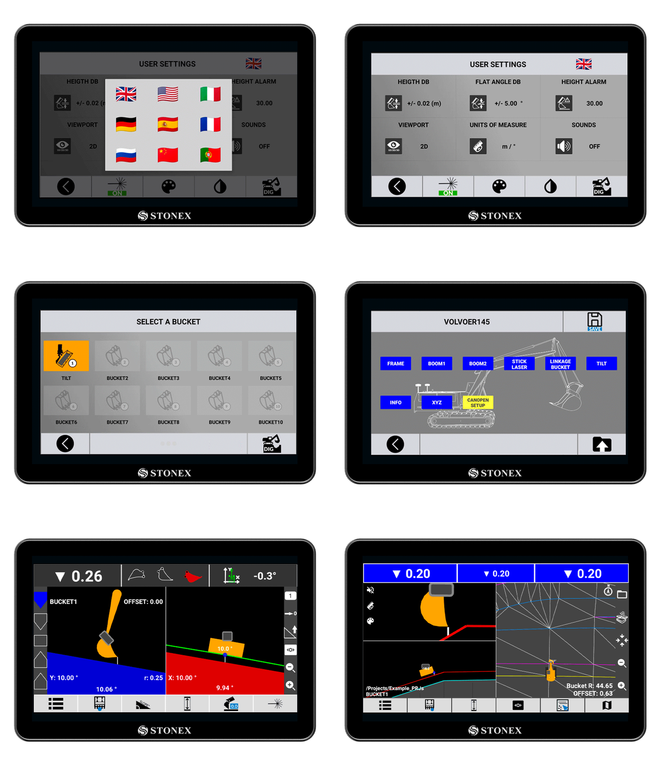
USER FRIENDLY SOFTWARE
Thanks to our software it is possible to set up and execute excavation operations quickly and easily.
The simple and clean interface has been specifically designed to achieve maximum efficiency in the field
For Android devices
User friendly interface
Developed by Stonex thinking of those who work in the field
Feature-rich and customizable
FAQ
STX-DIG is a universal and scalable platform, compatible with virtually any type of excavator — from mini to heavy-duty machines.
- STX-DIG 1D
Entry-level excavator machine control. It uses sensors to determine the bucket’s position in one dimension (side view). Digging is only possible along the boom direction. If you rotate the boom or move the machine, you’ll need to transfer height using a reference point or an optional laser sensor. - STX-DIG 2D
Builds upon 1D by adding dual GNSS antennas, allowing the system to determine heading, allowing you rotate the boom around the frame during operation. However, when moving the machine to a new location, you’ll still need a reference point or laser sensor to maintain height accuracy. - STX-DIG 3D Pro
The most advanced and professional solution, combining sensor data with SMC-TWO GNSS receiver (dual antennas) and supports NTRIP/UHF corrections for precise positioning across the job site. Move the machine freely without recalibration and use office-created projects or create new ones locally via Apollo.
Yes, STX-DIG supports dual-boom machines. An optional dual boom sensor would be required.
- Tilt bucket: Yes. Requires an optional tilt sensor (supported in 2D and 3D Pro only).
- Tilt-rotator: Yes, but the machine must be equipped with a factory-installed rotation sensor and ECU, as well as be connected via a special CAN bus cable (supported in 3D Pro only).
Not yet. Swing boom support is currently not available but is in development.
Yes. Thanks to its modular and scalable architecture, you can upgrade to 2D or 3D Pro by simply adding the necessary components — no need to replace existing ones.
Lorem ipsum dolor sit amet, consectetur adipiscing elit
Lorem ipsum dolor sit amet, consectetur adipiscing elit. Ut elit tellus, luctus nec ullamcorper mattis, pulvinar dapibus leo.
