MONITORING
Stonex offers a complete hardware and software system for engineering applications built on the industry-leading Stonex total stations, GNSS technology and field software you already know.
Integrated models can also easily be created by combining Laser scanner point clouds, photos, photogrammetric models, thermal images, Satellite/Aerial imagery.

Stonex provides advanced monitoring solutions for structural, geotechnical and environmental applications. Our systems are based on Robotic Total Stations and GNSS Receivers, enabling high-precision data acquisition for long-term deformation and stability analysis.
Total Station solutions provide millimetric accuracy for detecting structural displacements, while GNSS systems ensure continuous, global positioning for long-range monitoring.
Both platforms support autonomous and scheduled measurements, long-term data archiving, real-time visualization through the Cube-h²⁴ software suite, and customizable alerts for critical thresholds.
Measure
Analyze
Detect
Alert
Protect
Cube-h24 is a software suite designed for monitoring applications, it gathers information about a selected site and allows surveyors and
engineers to remotely evaluate the collected data. This software is developed for Microsoft Windows and Linux OS, it offers the possibility
to download, manage, and process the data collected from one or more sensors installed on the monitoring site.
The presence of a web interface enriches the functionality of Cube-h24.
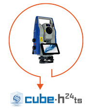
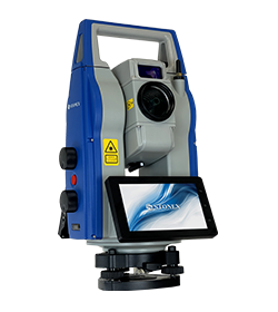
Ideal for high-precision deformation monitoring, this system enables automated or operator-assisted data collection using our Robotic Total Stations (available with 0.5″ or 1″ angular accuracy).
It supports both continuous and periodic measurements, offering millimetric accuracy for detecting structural movements. Data is securely
stored for long-term analysis and can be visualized through intuitive interfaces provided by the Cube-h²⁴ TS monitoring software.
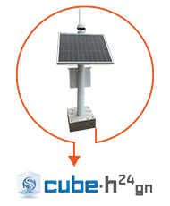
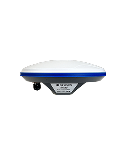
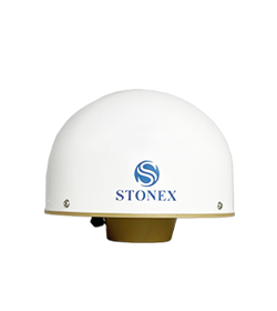
Designed for applications requiring global positioning and long-range stability analysis, this system employs advanced GNSS receivers and antennas.
These systems deliver continuous, high-precision geospatial data with real-time streaming capabilities, long-term storage, and seamless integration with Cube-h²⁴ GN software.
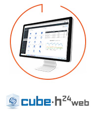
Cube-h24 WEB allows the user to configure working parameters, review and publish the calculation results. This software will help operators, providing the best functions for data transferring, graphical visualization, and alarm system management.
High precision instruments
Our instruments can work in every environment
Robust and durable equipment
Powerful Hardware
Lorem ipsum dolor sit amet, consectetur adipiscing elit
Lorem ipsum dolor sit amet, consectetur adipiscing elit. Ut elit tellus, luctus nec ullamcorper mattis, pulvinar dapibus leo.