The company
Stonex Careers
Certifications
GNSS ReceiversGIS & Mobile GNSSTablets & ControllersRadioSoftware
GNSS AntennasCORS GNSS ReceiversSoftware
Total StationsOne Pole SolutionLevels & TheodolitesSoftware
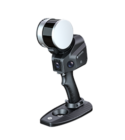
SLAM Laser ScannersVisual SLAM ScannersTerrestrial Laser ScannersUAV PayloadsSoftware
FIELDCube-aCube-connector
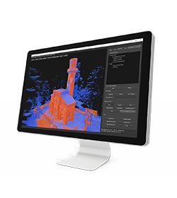
OFFICECube-3dCube-managerCube-nrtk
Earthmoving & ConstructionAgricultureMarineGNSS & OEMLasersSoftware
Custom solutions
3D Scanning
Agriculture & Precision Farming
Architecture & Construction
Bim
Cadastral
Drill & Mining
Earthmoving
Engineering
Forestry
Geology
GIS & Mapping
Heritage & Archaeology
Marine Operations
Mobile Mapping
Monitoring
Public safety
Roads
Solar
Surveying
Utilities
New products
Company news & Press releases
Tradeshows
Trainings & Webinars
Case Studies
Find a dealer
Become a dealer
SURVEY GNSS
GNSS NETWORK
OPTICAL SURVEYING
3D SCANNING
CUBE-SUITE SOFTWARE
MACHINE CONTROL
SPECIAL PROJECTS
Stonex instruments make it easy to collect geospatial data on the go. Our SLAM can be mounted on moving vehicles thanks to the dedicated accessory and our Lidar solution offers different configurations based on needs.
Car mount available
Our instruments can work in every environment
Lidar available for for different drone models
High precision instruments
A complete survey with Stonex Intruments
* Mandatory field