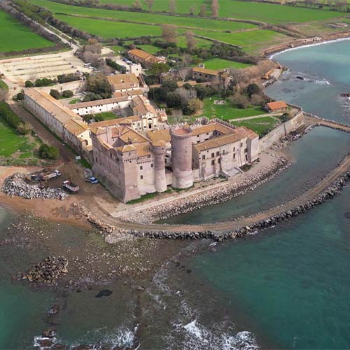
Last year, Stonex tackled an extraordinary technological challenge: the survey of the majestic Santa Severa Castle, a true historical and cultural jewel located on the Tyrrhenian coast north of Rome.
This evocative site, with deep roots dating back to ancient Pyrgi in the 7th century BC, has seen the succession of Etruscans, Romans, Phoenicians and many others, until it became a German military base during the Second World War.
Today, after centuries of history and a period of abandonment, the castle is a vibrant cultural center, hosting museums, events and a hostel.
A journey through time: Stonex technologies in action
To best document and enhance this unique site, Stonex has employed a wide range of cutting-edge technologies. Thanks to the combined use of 3D scanners, GNSS and total stations, the entire area has been mapped with millimetric precision, allowing the creation of a detailed three-dimensional model, both for the interiors and exteriors.
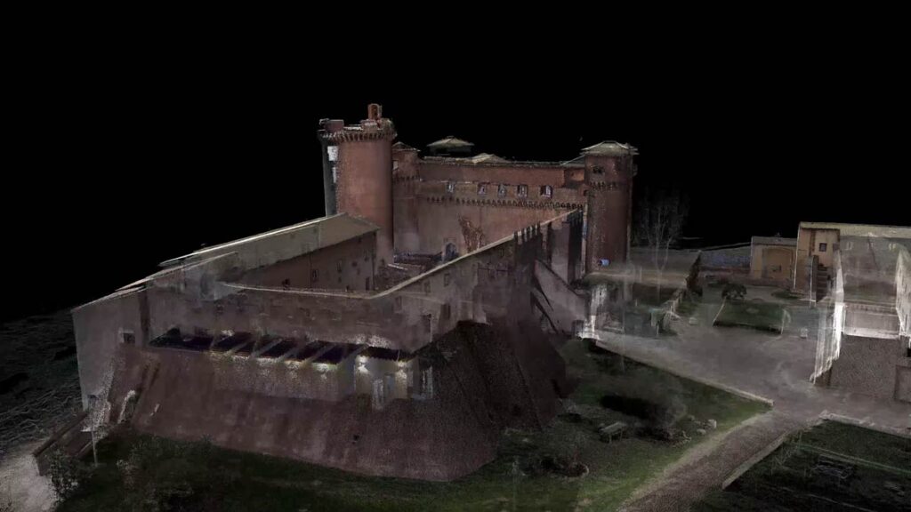
The work on the exterior of the castle was carried out with the SLAM X120GO, capable of capturing every detail with just two 30-minute scans each, thanks to its 120-meter range. Furthermore, thanks to the use of Ground Control Points (GCP) for georeferencing and point cloud compensation, an extremely accurate picture of the site was obtained. To complete the external survey, a drone equipped with the XFLY lidar was used, which made it possible to map roofs and areas not visible from the ground.
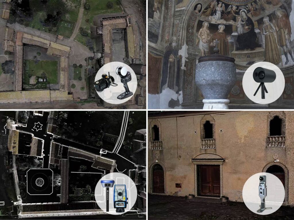
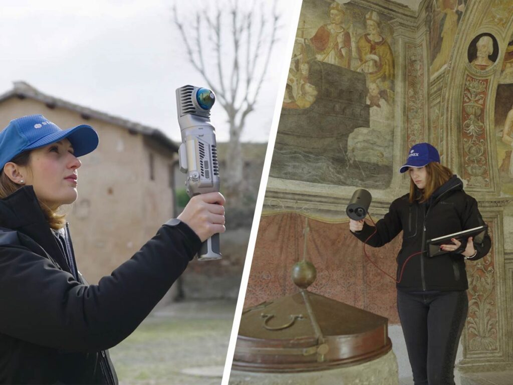
The interiors of the castle, now converted into museum spaces, were surveyed with the SLAM X70GO. With its ability to detect narrow and cramped spaces, such as the stairs of the tower, it proved to be perfect for reconstructing architectural details of great values. The X-Whizz mode, in particular, made it possible to combine the speed of the SLAM survey with the precision of static scans lasting a few seconds, thus obtaining a perfect mix of speed and accuracy.
A further level of detail was achieved with the vSLAM XVS scanner, used to return very high-resolution point clouds of the most delicate environments, such as the early Christian church and the baptistery, where precious frescoes and an ancient baptismal font are preserved.
Topographic precision and data integration
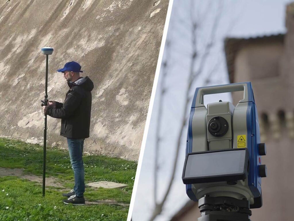
In addition to scanning technologies, the S990+ GNSS receiver and the R180 robotic total station, together with the Cube-a software, played a fundamental role in the topographic survey of the area. Essential data were collected for the framing of the castle and its integration into the surrounding context.
Thanks to Cube-a, points and polylines of elements such as sidewalks and edges were acquired very easily, allowing for smooth integration with the generated 3D models.
All the data, from the point clouds to the topographic survey, were imported and merged into the Cube-3d software, where it was possible to proceed with the creation of detailed sections and plans in dxf format.
Conclusions: an excellent result in a short time
In less than a day of work, just two Stonex operators were able to survey the entire area of the Santa Severa Castle thanks to the power of SLAM technology. This solution allowed covering large areas in very short times, while ensuring an extraordinary level of detail. The X-whizz mode of X70GO and the XVS videogrammetric scanner offered ideal solutions for capturing the most complex and detailed architectural elements.
The integration of different technologies proved to be a real strength, offering a winning combination of speed, precision and quality. Stonex continues to demonstrate that innovation, when applied to historical heritage, can open new perspectives and contribute to the protection and enhancement of iconic places such as the Santa Severa Castle.