
3D Survey for Forest management and Tree extraction information
1. Introduction
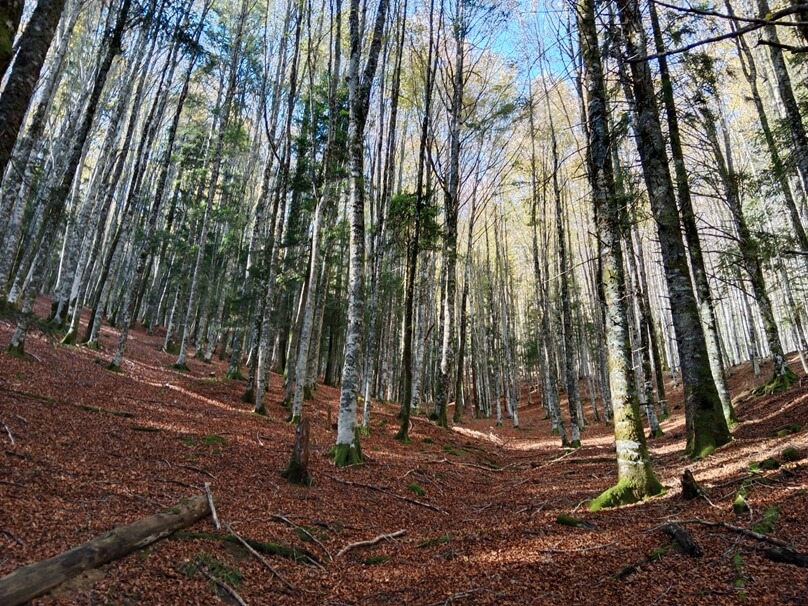
Scans were carried out in an Austrian forest to demonstrate the capabilities of SLAM technology in woodland environments. Two sections of forest were surveyed with different types of terrain and conditions.
In addition, the ability to georeference the point cloud was tested, with and without good internet coverage. Final point clouds are used to extract single tree information for forest management.
2. The Challenge
Forests are tough environments for surveying: GNSS signal occlusion, poor connectivity, and rugged terrain make accurate mapping a real test.
The goal? Create a dense, precise 3D model of the forest and georeference it – even in areas without internet.
3. Adopted Solution
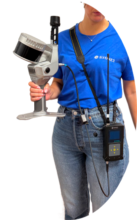
The survey was carried out using the Stonex X120GO SLAM scanner in handheld mode. For the section without internet coverage, we adopted an S900+ GNSS receiver as a base station and connected an SR02 external radio modem to the scanner. This configuration allowed real-time corrections in areas where internet connections are not available.
4. Field Operations
First forest section
- Survey Area: 5 hectares of dense forest (split into 2 sub-acquisitions).
- Devices setup: X120GO SLAM scanner
- RTK Connectivity: via internet (GSM)
Second forest section
- Survey Area: 2 hectares of dense forest.
- Devices setup: X120GO SLAM scanner + SR02 radio + Stonex S900+ base station
- RTK Connectivity: via radio
Despite the challenging conditions, both surveys were completed in a single morning. The second section required additional setup for the base station, but once configured, the scanner achieved fixed positions in two key areas—enough to ensure accurate orientation and georeferencing.
5. Data Processing
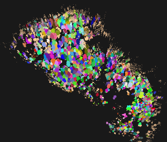
- SLAM data processed using GOpost
- Segment merging based on overlap and GNSS alignment
- Cleaning and optimisation in Cube-3d
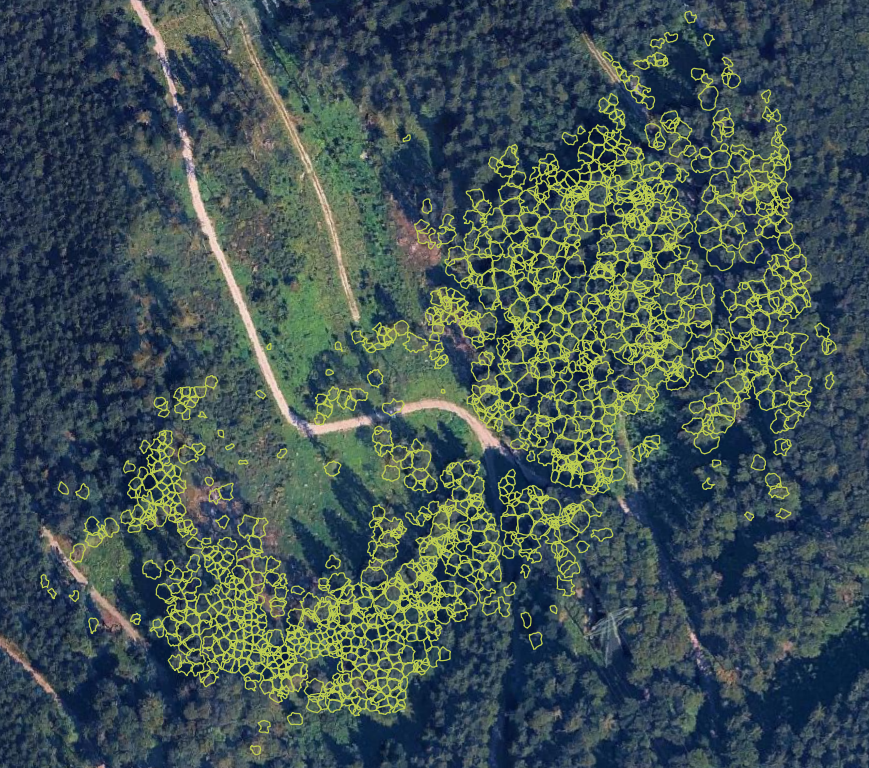
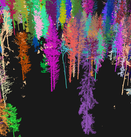
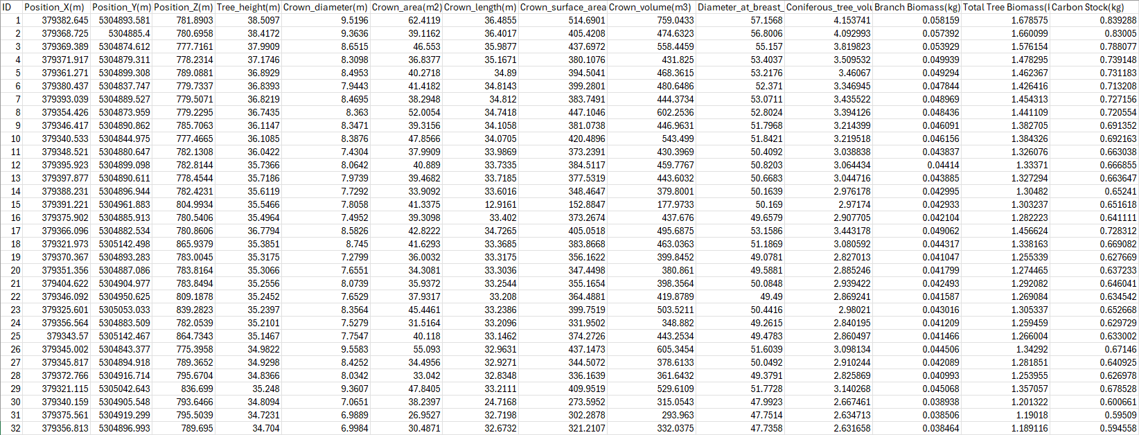
- Tree classification and analysis with dedicated software
6. Survey Possible Outcomes
- Georeferenced high-resolution point cloud of the forest.
- 3D models of the trees, with the possibility to extract single tree information.
- Single tree parameters extraction.
- Digital Terrain Model (DTM)
- Longitudinal and transverse profiles, slope analysis, and contour lines.
- Environmental information for harvesting and forest inventory.
7. Applications
- Forest Inventory: Monitor tree growth and forest health
- Harvesting Decisions: Extract parameters for sustainable logging
- Infrastructure Planning: Model paths and utilities within forested areas
- Environmental Modeling: Analyze runoff, drainage, and vegetation impact
8. Research Value
This case study highlights:
- SLAM’s effectiveness in GNSS-challenged environments
- Integration of SLAM + GNSS + radio corrections for robust workflows
- Practical use of SLAM for forestry applications
10. Conclusions
The Austrian Forest survey demonstrates that SLAM technology, combined with the right instruments, can deliver precise, georeferenced data even in difficult conditions. The Stonex X120GO proved its capability to document complex environments efficiently. When paired with advanced processing tools, SLAM data becomes a powerful resource for sustainable forest management.